File:Slater Intro Table2.jpg
Revision as of 15:30, 31 January 2017 by Debra Tabron (talk | contribs) (Table 2. Surface-based geophysical methods commonly used at remediation sites. The extent and depth of the survey region and the resolution are all approximate ranges. The measured parameters can be derived directly from the acquired data. The recovere...)
Size of this preview: 471 × 599 pixels. Other resolutions: 189 × 240 pixels | 2,483 × 3,159 pixels.
Original file (2,483 × 3,159 pixels, file size: 1.4 MB, MIME type: image/jpeg)
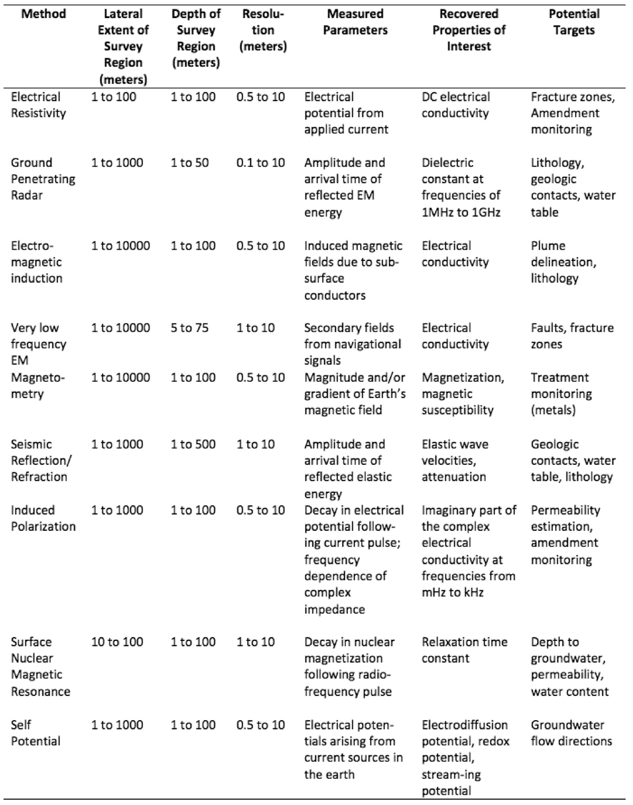
Table 2. Surface-based geophysical methods commonly used at remediation sites. The extent and depth of the survey region and the resolution are all approximate ranges. The measured parameters can be derived directly from the acquired data. The recovered properties are obtained through processing and/or inversion of the acquired data.
File history
Click on a date/time to view the file as it appeared at that time.
| Date/Time | Thumbnail | Dimensions | User | Comment | |
|---|---|---|---|---|---|
| current | 15:30, 31 January 2017 | | 2,483 × 3,159 (1.4 MB) | Debra Tabron (talk | contribs) | Table 2. Surface-based geophysical methods commonly used at remediation sites. The extent and depth of the survey region and the resolution are all approximate ranges. The measured parameters can be derived directly from the acquired data. The recovere... |
- You cannot overwrite this file.
File usage
The following page links to this file: