Difference between revisions of "File:Bekins1w2 Fig1.jpg"
Debra Tabron (talk | contribs) (Figure 1. Map of the site located near Bemidji, MN, showing oil pipelines, location of 1979 rupture, oil bodies at the water table, area sprayed by oil, direction of flow, the 10 ppb BTEX contour and the down-gradient lake. Figure reprinted from McGuir...) |
(No difference)
|
Latest revision as of 17:44, 13 June 2019
Summary
Figure 1. Map of the site located near Bemidji, MN, showing oil pipelines, location of 1979 rupture, oil bodies at the water table, area sprayed by oil, direction of flow, the 10 ppb BTEX contour and the down-gradient lake. Figure reprinted from McGuire, et.al.
File history
Click on a date/time to view the file as it appeared at that time.
| Date/Time | Thumbnail | Dimensions | User | Comment | |
|---|---|---|---|---|---|
| current | 17:44, 13 June 2019 | 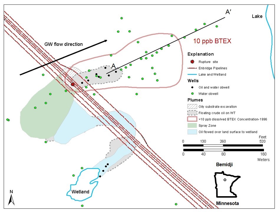 | 947 × 731 (124 KB) | Debra Tabron (talk | contribs) | Figure 1. Map of the site located near Bemidji, MN, showing oil pipelines, location of 1979 rupture, oil bodies at the water table, area sprayed by oil, direction of flow, the 10 ppb BTEX contour and the down-gradient lake. Figure reprinted from McGuir... |
- You cannot overwrite this file.
File usage
The following file is a duplicate of this file (more details):
The following page links to this file: